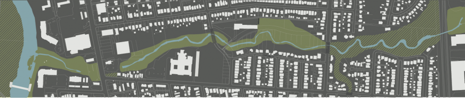
Maps and images, primarily historical, in and around Glen Echo Ravine.
1872: North Columbus & Glen Echo Ravine & Stream Area
Source: J.A. Caldwell & H.T. Gould. Atlas of Franklin Co., Ohio. Columbus, OH, 1872.
Note: Glen Echo Stream is called “Vineyard Creek” in reference to the vineyard in what is now the area just south and west of Indianola Ave. and Olentangy St. The large building (near the number 81) is Joseph Guitner’s home, later converted into a hotel. It is on the site of what is currently Lucky’s Market. Notice also the stream just north of Guitner’s property, flowing through South Clintonville (got water in your basement?).

1877: Columbus Sewer Pipe Company Letterhead
Source: James L. Murphy. 2011. The Trimble and Wassail Brick Companies, Athens County, Ohio. Contributions to Ohio Ceramic History No.7. PDF Here.

1887: Columbus Sewer Pipe Company advertisement
Source: American Architect and Building News, vol. XXII, no. 606, p. xx.
Note: You may have collapsed drain pipes around your house just like the ones shown in this advert.

1891: Columbus Sewer Pipe Company from Sanborn Maps of Columbus
Source: Sanborn Maps, Columbus, 1891
Note: Old North High School (now North International High School) is built on the site of the Columbus Sewer Pipe Co. Notice the dam and pond filling in Glen Echo Ravine, just to the north of the Sewer Pipe Co. Arcadia Ave. is under its original name, Mock Road.

1901: American Sewer Pipe Company from Sanborn Maps of Columbus
Source: Sanborn Maps, Columbus, 1901
Note: American Sewer Pipe Company purchased the Columbus Sewer Pipe Co. The dam and pond are still in Glen Echo Ravine.
1904: USGS Topographic Map, 1:62k scale, Columbus, Ohio
Source: USGS Topographic Map, 15′ Series, 1904.
Note: This US Geological Survey topographic map from 1901 shows the spur railroad line from the main (and current) rail line, just west of I-71, to the site of the Sewer Pipe location. The foot bridge just east of the Calumet St. bridge carried the rail grade over the Ravine.
1907: Postcard of the Olentangy Park Picnic Grounds
Note: The postcard shows the picnic area in the Ravine just west of High St. The bridge connected the area just behind Patrick J’s Restaurant, a turn-around and station for the High St. street cars, to the main area of Olentangy Park (the current Giant Eagle grocery store and surrounding Olentangy Village.
1910: Postcard of the Olentangy Park Bridge over Glen Echo Ravine
Note: The postcard shows the foot bridge over Glen Echo Ravine picnic area in the Ravine just west of High St. The bridge connected the area just behind Patrick J’s Restaurant, a turn-around and station for the High St. street cars, to the main area of Olentangy Park (the current Giant Eagle grocery store and surrounding Olentangy Village).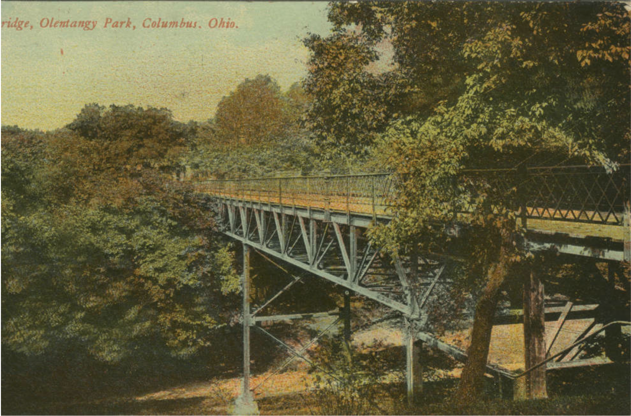
1920: Baist’s Atlas of Columbus (Plate 26, detail)
Source: Baist’s Atlas of Columbus. Philadelphia, 1920.
Note: Baist’s atlases were used to research property information for real estate transactions. By 1920, the American Clay Manufacturing Co. and Gaddis Harrison Brick Co. occupy the site of the previous sewer pipe factories.
1920: Advertisement, American Vitrified Products Co.
Source: City Manager’s Yearbook, 6th ed., 1920.
Note: Yet another occupant of the site now occupied by North International High School.

1921: Gaddis Harrison Brick Co., from Sanborn Maps of Columbus
Source: Sanborn Maps, Columbus, 1921
Note: Seems as if the dam and pond in Glen Echo Ravine are gone.
1926: Calumet St. Bridge over Glen Echo Ravine
Source: Columbus North High School Yearbook, 1926
Note: This image, taken in the winter, shows the Calumet St. bridge relatively soon after it was built over Glen Echo Ravine.
1941: White Castle, looking north-west from High St.

1952: American Sewer Pipe Company from Sanborn Maps of Columbus
Note: Air photo of N. High St. and Glen Echo Ravine intersection, looking west.

Fantastic. Thanks for finding and sharing all this great local history.
LikeLike
Does anyone have aerial photos of the Columbus Sewer Pipe Factory in 1921 where Columbus North HS was built. I am a 1967 grad? Thx Ron Savage 5-11-2017
LikeLike
I did search for older air imagery for the Glen Echo Ravine area, but found nothing earlier than the 1970s. As far as I know there was no systematic attempt to take air imagery in Ohio until after WW2. You may want to contact the Ohio State U. Map Library, as they should know if any air imagery as early as 1921 exists. I doubt it! But if you find anything, do let me know.
LikeLike
John Krygier
Thank you so much for your reply. I will see what I can come up with.
Thx.
Ron Savage
5-12-2017 at 1011PM
LikeLike
Hi Ron,
This page has a link to a 1932 aerial photo taken by then OSU graduate student Curtis E. LeMay.
I believe the Columbus Sewer Pipe Factory would have been where the western parking lot is for North High based on maps I’ve seen via the Columbus Metropolitan Library. I’ll let you know if I find more info/maps/photos!
-Mike
http://www.columbusrailroads.com/new/utility/display_html.php?htmltitle=North+Columbus&file=.%2Flive%2F05Steam_Railroads%2F21Aerial_Photos%2Faerial_north_cbls.htm
LikeLike